 |
| Segment One, Cut 5 to Cut 4 looking south...ferry terminal lanes below |
 |
| Lions Bay area before upgrades |
 |
| Look on the rail tracks...blast mats laid down to protect the rails from falling rock |
 |
| Large MSE wall and rail tracks below....Howe Sound below that.. |
 |
| Below the highway and above the tracks |
 |
| Large drainage pipe...and the detour around the work |
 |
| Segment One...Larsen Creek Bridge to Cut 6....West Van/Horseshoe Bay in the background |
 |
| Segment Two....teaser pic...I'm going write up a separate feature on this through-cut corner |
 |
| Segment One, south interchange under construction. Eagleridge area, Marine Drive also. |
 |
| Cut 4, Segment One...and existing road to and from Horseshoe Bay ferry terminal |
 |
| Porteau area looking south |
 |
| Bridgework coming into Squamish from Vancouver |
 |
| Squamish Chief climbers campground area....looking south |
 |
| Getting ready to install a bridge....looking south towards Squamish |
 |
| Darrell Bay |
 |
| MSE wall coming up below existing highway |
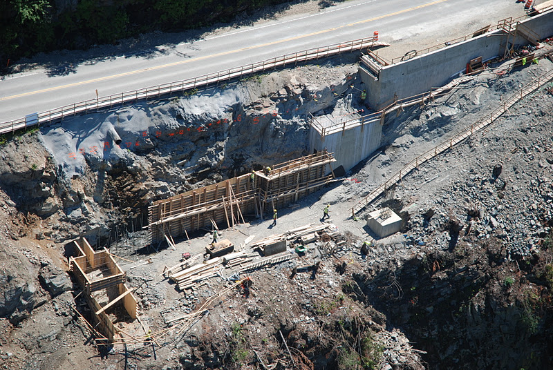 | |
| More below the road construction action |
 |
| High overhead view of bridge going into Squamish, coming from Vancouver side |
 | |
| Interesting aerial perspective of a dredging operation....not related to the highway upgrade |
No comments:
Post a Comment